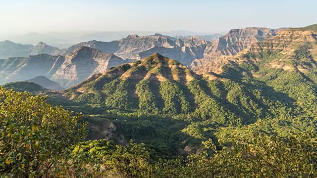
Maharashtra is far more than the financial capital of India — it is a state of breathtaking geographical diversity. Stretching across the mighty Sahyadri (Western Ghats) mountain range, the Vidarbha plateau, and the Konkan coastal belt, Maharashtra shelters some of the most enchanting hill stations in the entire Indian subcontinent.
These hill stations are not only prized tourist destinations but also hold significant importance from an exam perspective. Questions related to the altitude, location (district), unique features, and special titles of these hill stations appear regularly in MPSC Prelims and other Maharashtra state-level examinations.
In this article, we will systematically cover the top 25 hill stations in Maharashtra, their key facts, geographical significance, and special characteristics — all presented in a way that is easy to memorize and quick to revise.
Geographical Overview: The Western Ghats Connection
Before diving into individual hill stations, understand this foundation:
- Almost all hill stations in Maharashtra are located along the Western Ghats (Sahyadri range), which runs parallel to the western coast of India.
- The Western Ghats are a UNESCO World Heritage Site and one of the world's eight hottest biodiversity hotspots.
- Maharashtra's hill stations lie primarily in the districts of Pune, Satara, Kolhapur, Raigad, Thane, Nashik, Amravati, Sindhudurg, and Nandurbar.
- The monsoon season (June–September) transforms these stations into lush green paradises, while winter months offer cool, misty retreats.
** Exam Tip:** Always remember the district in which each hill station is located — this is the most frequently tested fact in objective-type questions.
Complete List of Major Hill Stations in Maharashtra
| Hill Station | District | Altitude (approx.) | Special Feature |
|---|---|---|---|
| Lonavala | Pune | ~622 m | Tiger's Leap, Bhushi Dam |
| Khandala | Pune | ~625 m | Twin of Lonavala |
| Matheran | Raigad | ~800 m (2,625 ft) | Asia's only automobile-free hill station |
| Mahabaleshwar | Satara | 1,353 m | Queen of Hill Stations; Strawberries |
| Igatpuri | Nashik | ~588 m | Vipassana International Academy |
| Panchgani | Satara | 1,293 m | Table Land plateau; Strawberry farms |
| Karjat | Raigad | ~110 m | Kondana Caves, Ulhas Valley |
| Amboli | Sindhudurg | ~690 m | Last hill station before Goa border |
| Chikhaldara | Amravati | 1,118 m | Only coffee-growing area in Maharashtra; highest in Vidarbha |
| Panhala | Kolhapur | ~1,200 m (3,937 ft) | Panhala Fort; historically significant |
| Suryamal | Thane | ~1,646 m (5,400 ft) | Highest hill station in Maharashtra |
| Malshej Ghat | Pune | ~732 m (2,400 ft) | Harishchandragad Fort trek |
| Bhandardara | Ahmednagar | ~1,311 m (4,300 ft) | Wilson Dam; Kalsubai peak nearby |
| Jawhar | Thane | ~823 m (2,700 ft) | Tribal culture; scenic sunset views |
| Koroli | Nashik | ~800 m | Sahyadri panoramic views; peaceful retreat |
| Sawantwadi | Sindhudurg | ~100 m | Near Maharashtra-Goa border; Lacquer Craft |
| Toranmal | Nandurbar | ~457 m (1,500 ft) | Waterfalls; tribal temples |
| Rajmachi | Pune | ~1,067 m (3,500 ft) | Rajmachi Fort; Sahyadri trekking |
| Durshet | Raigad | ~701 m (2,300 ft) | Historical; Shivaji Maharaj battles; hot springs |
| Lavasa | Pune | ~610 m (2,000 ft) | Italian-inspired planned hill city |
| Satara | Satara | ~762 m (2,500 ft) | Ajinkyatara Fort; "Queen of Hills" |
| Wai | Satara | ~762 m (2,500 ft) | Sahyadri Fort; Wai Art Gallery |
| Bhimashankar | Pune | ~914 m (3,000 ft) | Bhimashankar Jyotirlinga; Wildlife Sanctuary |
| Tamhini Ghat | Raigad | ~914 m (3,000 ft) | Tamhini Reservoir; Sahyadri range |
| Mhaismal | Thane | ~1,524 m (5,000 ft) | Vihigaon trekking; Buddhist meditation retreats |
Detailed Notes on Key Hill Stations
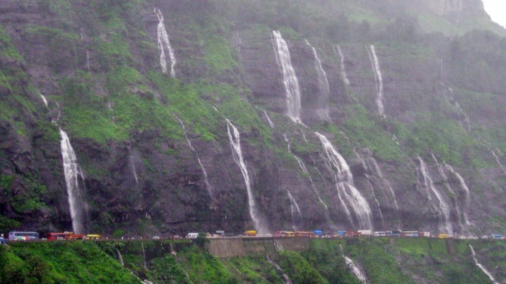
1. Lonavala — The Gateway to the Ghats
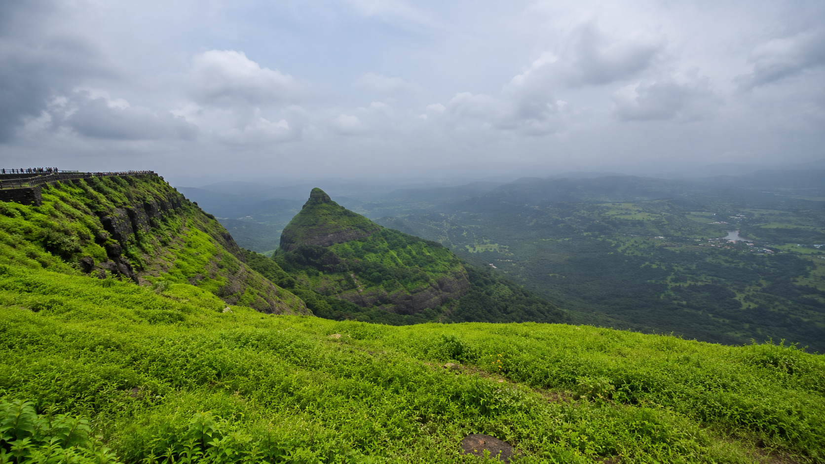
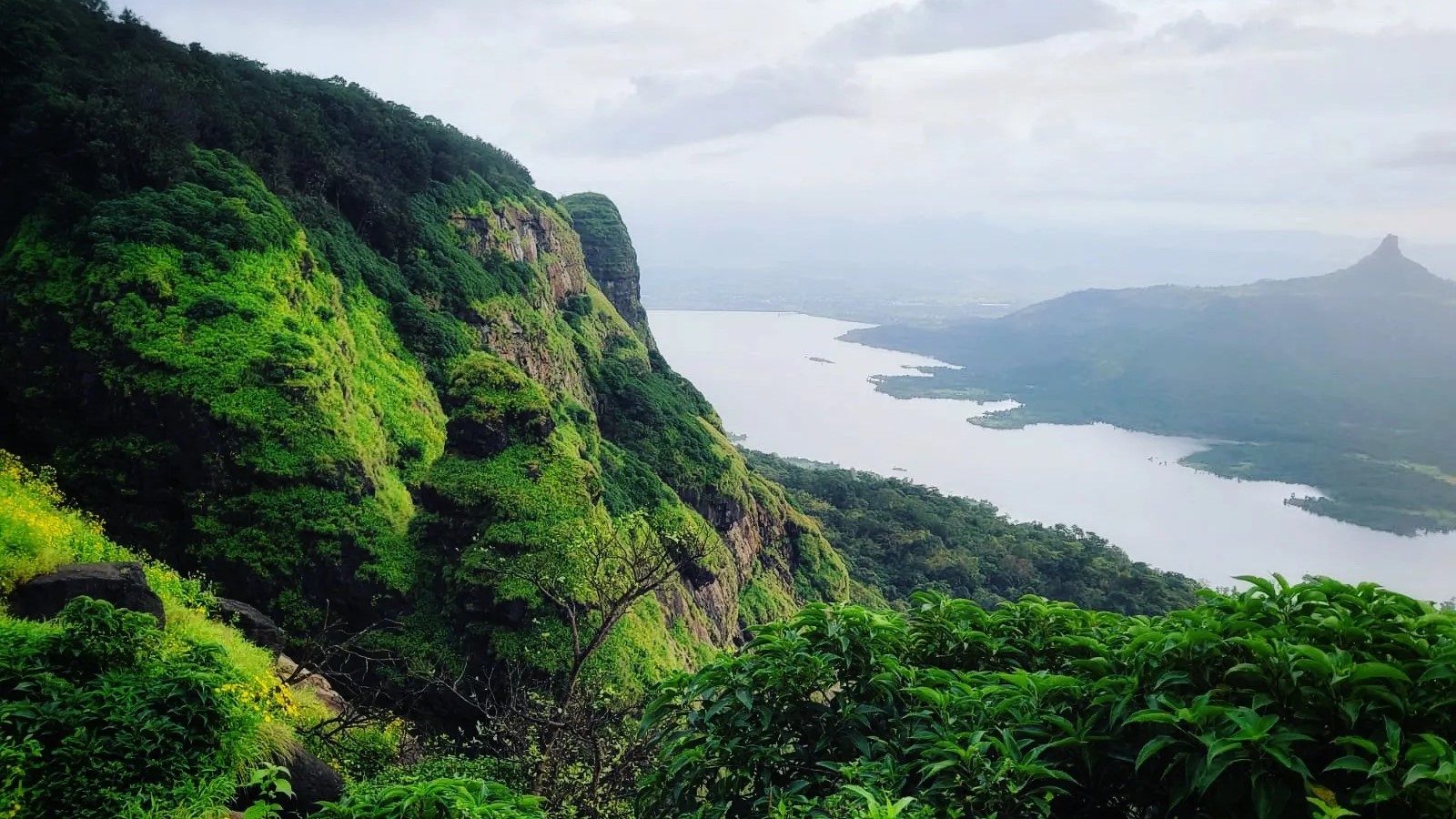
Lonavala is undoubtedly the most popular hill station in Maharashtra, strategically positioned in the Pune district along the Western Ghats. Situated at approximately 622 metres above sea level, it is easily accessible from both Mumbai (~83 km) and Pune (~65 km), making it a favourite weekend retreat for millions.
Key Facts to Remember:
- Famous viewpoints: Rajmachi Point, Tiger's Leap (Duke's Nose), Tiger Point
- Water body: Bhushi Dam (a popular monsoon attraction)
- Adventure hub: Trekking, camping, rock-climbing, and paragliding
- The Duke's Nose (also called Nagphani) is the highest point in Lonavala, offering panoramic views of surrounding valleys
- Famous local product: Chikki (a traditional sweet made of jaggery and peanuts/sesame)
** Exam Note:** Duke's Nose = highest point in Lonavala. Lonavala is in Pune district.
2. Khandala — Lonavala's Twin Jewel
Located just a few kilometres from Lonavala in Pune district, Khandala shares its geographical backdrop — lush green valleys, cascading waterfalls, and mist-draped mountains. The two towns are often collectively referred to in the same breath, yet Khandala has a quieter, more intimate character compared to its busier twin.
Key Facts:
- Located in the Western Ghats, Pune district
- Famous for scenic views of Bhore Ghat (Bhor Ghat)
- Popular viewpoints: Sunset Point, Reversing Station
- Shelly's Point offers commanding views of the valley
3. Matheran — Asia's Only Automobile-Free Hill Station
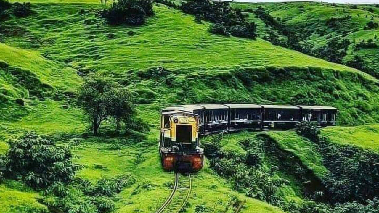
Matheran is truly one-of-a-kind. Located in the Raigad district, approximately 80 km from Mumbai, this charming hill station holds the extraordinary distinction of being Asia's only automobile-free hill station — meaning no motorised vehicles are allowed within the town limits, preserving its pristine environment and tranquility.
Key Facts:
- Altitude: 2,625 feet (approximately 800 m) above sea level
- Famous for its toy train (narrow-gauge heritage railway) from Neral — a unique and beloved attraction
- District: Raigad
- Charlotte Lake is the primary water source
- Popular viewpoints: Panorama Point, Echo Point, Louisa Point, One Tree Hill
- Declared a eco-sensitive zone by the Maharashtra government
** Exam Note:** Matheran = Asia's only automobile-free hill station + Raigad district — this fact is extremely frequently tested!
4. Mahabaleshwar — Queen of Hill Stations
Mahabaleshwar is the crown jewel among Maharashtra's hill stations, justifiably earning the title "Queen of Hill Stations". Situated in the Satara district at an altitude of 1,353 metres (4,439 feet) above sea level within the Sahyadri mountain range, it is the highest among the most prominent tourist hill stations of Maharashtra.
Key Facts:
- Altitude: 1,353 m above sea level
- District: Satara
- Title: "Queen of Hill Stations" of Maharashtra
- Famous for: Strawberry cultivation — produces some of India's finest strawberries
- Five rivers originate here: Krishna, Koyna, Venna, Savitri, and Gayatri
- Key viewpoints: Arthur's Seat, Wilson Point, Elephant's Head Point, Kate's Point
- Old Mahabaleshwar houses the ancient Mahabaleshwar Temple (dedicated to Lord Shiva)
- During British rule, it served as the summer capital of Bombay Presidency
** Exam Note:** Five rivers origin at Mahabaleshwar. It was the summer capital of Bombay Presidency.
5. Igatpuri — The Meditation Mountain
Located in the Nashik district within the Western Ghats, Igatpuri is celebrated as much for its spiritual significance as for its natural grandeur. Surrounded by mist-laden forests and serene hills, it offers a complete escape from urban stress.
Key Facts:
- District: Nashik
- Home to the globally renowned Vipassana International Academy (Dhamma Giri) — one of the world's largest meditation centres
- Popular tourist spots: Bhatsa River Valley, Camel Valley, Ghatandevi Temple, Tringalwadi Fort, Amruteshwar Temple
- Adventure activities: Trekking, camping
- Also known for vineyards and wineries that offer wine-tasting experiences
- Well-connected by both road and rail (on the Mumbai–Nasik railway line)
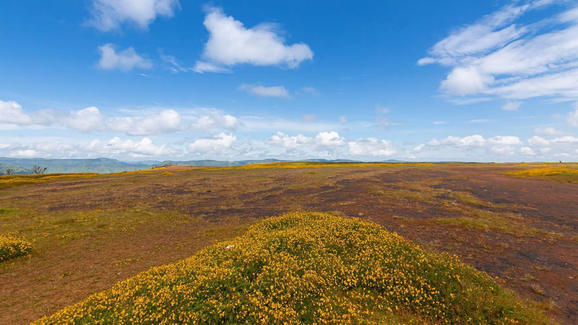
Panchgani, meaning "Five Hills," sits at 1,293 metres above sea level in Satara district and is famous for the Table Land — one of the largest dormant volcanic plateaus in Asia, formed from basaltic lava flow.
Key Facts:
- Altitude: 1,293 m; District: Satara
- Famous for Table Land — a vast flat volcanic plateau
- Popular for strawberry picking (especially Oct–Feb)
- Key viewpoints: Parsi Point, Sydney Point, Devil's Kitchen
- Named after five surrounding hills (panch = five, gani = hills)
- Popular boarding schools and educational institutions add to its character
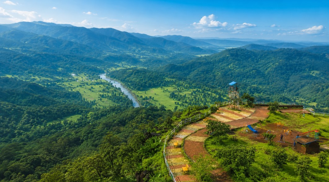
7. Chikhaldara — Vidarbha's Only Hill Station
Chikhaldara is a remarkable hill station located in the Amravati district of the Vidarbha region. It stands apart from most Maharashtra hill stations which are in the Western Ghats — Chikhaldara is situated in the Satpura range.
Key Facts:
- District: Amravati
- Altitude: 1,118 m — Highest hill station in the Vidarbha region
- Only coffee-growing region in Maharashtra
- Part of the Melghat Tiger Reserve — rich in wildlife (tigers, leopards, Indian bison)
- Mythological significance: Believed to be where Bhima (Pandava) killed Kichak
- Keechakdara → Chikhaldara (etymological origin of the name)
- Key attractions: Gavilgad Fort, Narnala Fort, Semadoh Lake
** Exam Note:** Chikhaldara = only coffee-growing area in Maharashtra + highest hill station in Vidarbha.
8. Panhala — The Fort Hill
Situated in Kolhapur district at approximately 1,200 metres (3,937 feet), Panhala is one of the oldest and most historically significant hill stations of Maharashtra. Its fame is inseparable from the legend of Chhatrapati Shivaji Maharaj.
Key Facts:
- District: Kolhapur; Altitude: ~3,937 ft
- Houses the Panhala Fort — the largest fort in the Deccan plateau
- Shivaji Maharaj spent significant time here and escaped from Aurangzeb's forces via the famous Pavan Khind (Ghodkhind) battle in 1660
- Contains several temples and historical monuments
9. Suryamal — The Highest Hill Station in Maharashtra
Suryamal holds the distinguished title of being the highest hill station in Maharashtra, perched at an altitude of approximately 5,400 feet (~1,646 m) above sea level. Located in the Western Ghats, this destination is a favourite among hardcore trekking enthusiasts.
Key Facts:
- Title: Highest hill station in Maharashtra
- Altitude: ~5,400 feet (~1,646 m)
- Located in Thane district in the Western Ghats
- Attracts trekkers who seek challenging ascents with panoramic rewards
- Rewards climbers with stunning views of the entire Sahyadri range
** Exam Note:** Suryamal = Highest hill station in Maharashtra — this is a guaranteed exam question!
10. Bhandardara — The Stargazer's Paradise
Located in Ahmednagar district at approximately 4,300 feet (1,311 m), Bhandardara is known for its strikingly beautiful reservoir and its proximity to Kalsubai — the highest peak in Maharashtra.
Key Facts:
- District: Ahmednagar; Altitude: ~4,300 ft
- Famous for the Wilson Dam on the Pravara river (one of India's earliest dams, built in 1910)
- Starting point for treks to Kalsubai Peak (1,646 m — highest peak in Maharashtra)
- Arthur Lake — a picturesque reservoir perfect for boating
- Beautiful waterfalls: Umbrella Falls, Randha Falls
- Popular for firefly festival during monsoon (June)
** Exam Note:** Bhandardara is near Kalsubai — the highest peak in Maharashtra (not to be confused with Suryamal which is the highest hill station).
11. Amboli — Maharashtra's Last Stop Before Goa
Nestled in the Sindhudurg district, Amboli is the last hill station of Maharashtra before the Goa border. It is a hidden gem that receives some of the highest rainfall in Maharashtra (over 7,000 mm annually), making it a paradise during monsoons.
Key Facts:
- District: Sindhudurg
- Designation: Last hill station in Maharashtra before the Goa border
- Located in the Sahyadri hills
- Best time to visit: Monsoon season (June–September) for waterfalls
- Famous for birdwatching and trekking through dense forests
- Home to Hiranyakeshi River origin point
12. Malshej Ghat — The Flamingo Crossing
Located in Pune district at 2,400 feet (732 m), Malshej Ghat is famous for its dramatic mountain passes, vibrant waterfalls, and uniquely for the flocks of pink flamingos that migrate here from the Rann of Kutch during monsoon.
Key Facts:
- District: Pune; Altitude: ~2,400 ft
- Famous for flamingo migration — a rare natural spectacle
- Nearby treks: Harishchandragad Fort (one of Maharashtra's most popular treks)
- Features: Malshej Falls, Ajoba Hill Fort, Pimpalgaon Joge Dam
- The pass connects Pune with Ahmednagar and Nashik districts
13. Bhimashankar — The Sacred Hill
Located in Pune district at approximately 3,000 feet (914 m), Bhimashankar is simultaneously a religious pilgrimage site and a biodiversity hotspot.
Key Facts:
- District: Pune
- Houses one of Maharashtra's 12 Jyotirlingas — the Bhimashankar Temple (dedicated to Lord Shiva)
- The Bhima River originates here
- Home to the Bhimashankar Wildlife Sanctuary — habitat of the Indian Giant Squirrel (Maharashtra's state animal)
- Dense forests, rich flora and fauna, several scenic waterfalls
** Exam Note:** Bhimashankar = Jyotirlinga + origin of Bhima River + Indian Giant Squirrel habitat
14. Jawhar — The Tribal Hill Town
Located in Thane district at approximately 2,700 feet, Jawhar was formerly a princely state and is celebrated as the "Mahabaleshwar of Thane district" due to its scenic elevation and pleasant climate.
Key Facts:
- District: Thane
- Famous for tribal culture and traditional Warli art
- Known for spectacular sunset views (Sunset Point)
- Nearby: Dabhosa Waterfall — one of Maharashtra's widest waterfalls
- Preserves its indigenous tribal heritage and natural environment
15. Lavasa — India's First Planned Hill City
A modern addition to Maharashtra's hill station landscape, Lavasa in Pune district is India's first planned hill city, inspired by the Italian coastal town of Portofino.
Key Facts:
- District: Pune; Elevation: ~2,000 ft
- Designed on the model of Italian hill-town architecture
- Located along the Warasgaon Lake (reservoir)
- Developed as a self-sustainable urban township
- Popular for lakeside promenades, water sports, and nature trails
Key Comparisons & Special Titles — High-Priority Exam Facts
| Title / Special Feature | Hill Station |
|---|---|
| Highest Hill Station in Maharashtra | Suryamal (~5,400 ft / ~1,646 m) |
| Highest Peak in Maharashtra | Kalsubai (near Bhandardara, ~1,646 m) |
| Queen of Hill Stations | Mahabaleshwar |
| Asia's only automobile-free hill station | Matheran |
| Only coffee-growing area in Maharashtra | Chikhaldara |
| Highest hill station in Vidarbha | Chikhaldara |
| Last hill station before Goa border | Amboli |
| Famous for toy train (heritage railway) | Matheran |
| Famous for strawberry cultivation | Mahabaleshwar & Panchgani |
| Five rivers originate here | Mahabaleshwar |
| India's first planned hill city | Lavasa |
| Famous for flamingo migration | Malshej Ghat |
| Bhimashankar Jyotirlinga location | Bhimashankar (Pune dist.) |
| Warli tribal art and culture | Jawhar |
| Panhala Fort — largest fort in Deccan | Panhala (Kolhapur dist.) |
Hill Stations by District — Quick Revision Map
| District | Hill Stations |
|---|---|
| Pune | Lonavala, Khandala, Malshej Ghat, Rajmachi, Bhimashankar, Lavasa, Tamhini Ghat |
| Satara | Mahabaleshwar, Panchgani, Satara, Wai |
| Raigad | Matheran, Karjat, Durshet, Tamhini Ghat |
| Nashik | Igatpuri, Koroli |
| Thane | Jawhar, Suryamal, Mhaismal |
| Amravati | Chikhaldara |
| Kolhapur | Panhala |
| Ahmednagar | Bhandardara |
| Sindhudurg | Amboli, Sawantwadi |
| Nandurbar | Toranmal |